
Dubai Municipality launches ‘Dubai Here’, an e-system that provides comprehensive geospatial data and maps of Dubai
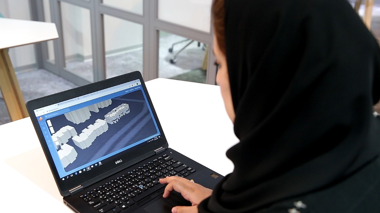
Dubai Municipality's Geographic Information Systems (GIS) Centre has launched ‘Dubai Here’, an electronic system that provides access to geospatial data and maps of the emirate.
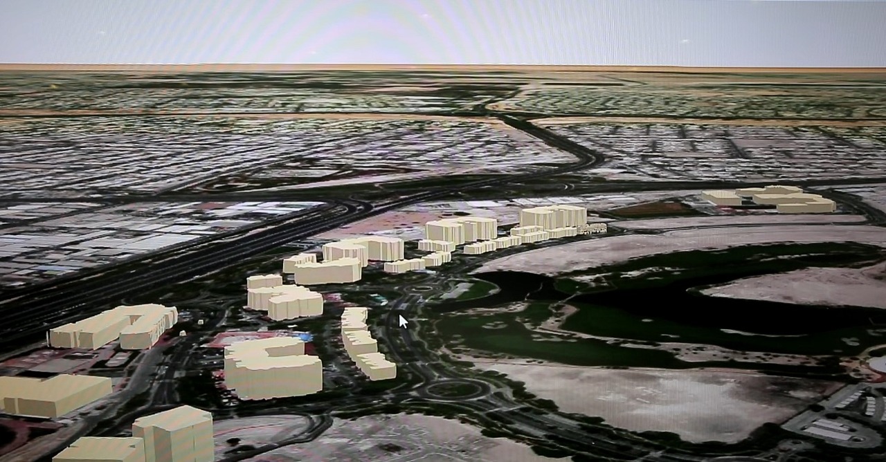
The new system features 2D and 3D maps of Dubai’s land plots, assets, landmarks, structures and infrastructure facilities, with details ranging from masterplans and interiors of buildings, including commercial and residential units, to external green areas, parks, trees, bridges, tunnels and service lines.
Accessible on a web browser or smart device, ‘Dubai Here’ is designed to be easily updated. The system displays maps from a comprehensive geospatial database which all parties can contribute to and update. The e-system provides access to details of housing units, service units and networks and information on economic activity, the environment, health and population.
Dawoud Al Hajri, Director General of Dubai Municipality, said: “Dubai Municipality is committed to providing high-quality services to customers by developing innovative technical solutions in accordance with the highest international standards. These services aim to help professionals in various fields utilise GIS technology in the decision-making process while also enhancing their overall user-experience.”
Al Hajri explained that geospatial data and maps are essential tools used for making decisions and completing projects in the areas of city planning, infrastructure, security and health, which contribute to providing smart services, promoting economic growth, anticipating the future and increasing the level of international competitiveness and leadership.
Al Hajri added that Dubai Municipality has expanded its GIS Centre in line with its vision to make Dubai a happy and sustainable city. The Centre aims to provide a ‘Digital Twin’ of Dubai in the form of 2D and 3D maps of the emirate’s assets, landmarks and structures. This digital edition, enhanced with IoT technologies and linked to real-time information, provides all the information necessary for planning and managing the city and providing effective smart services.
To achieve this goal, the GIS Centre recently launched ‘GeoDubai’, an initiative that provides unique services and support to government, educational and private entities in the field of maps. GeoDubai provides a comprehensive and unified base map that provides the background detail necessary for all engineering, planning and development work in Dubai, including city planning conducted by the Municipality or free zone authorities; zoning and identification of land plots; and planning and implementation of service networks. It enables authorities in Dubai to coordinate and cooperate to complete and update maps and information necessary to create Dubai’s ‘Digital Twin’.
Through GeoDubai, the GIS Center provides unique services to members of the Dubai Geospatial community including various kinds of maps, data, technical consultations, specialised training, software licenses, photography aerial using drones and geospatial survey of streets using a specialised vehicle. These services can be requested through the website, www.GeoDubai.ae
More on these topics
Most Recent News

Mansoor bin Mohammed commends UAE athletes for making the country proud and inspiring the youth

Government of Dubai Media Office celebrates the graduation of the third cohort of the DXB500 Programme

 For an optimal experience please
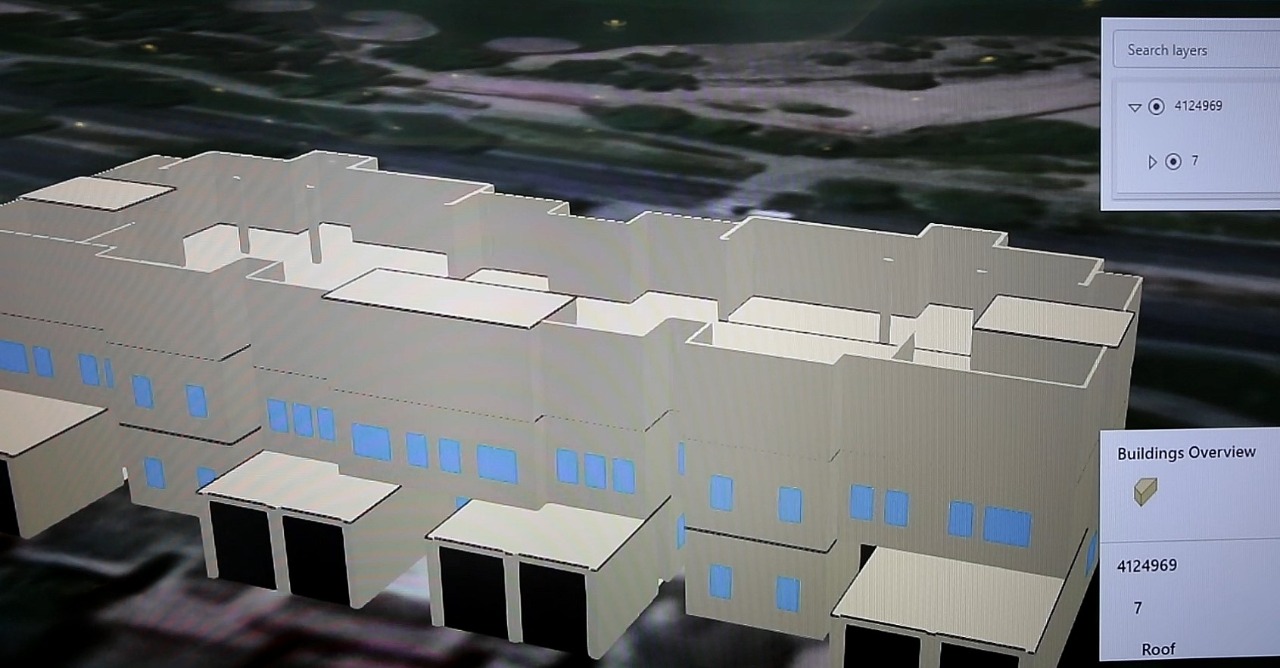